Garmin eTrex Summit Handheld Navigator
Garmin Updated: 2008-09-16 RSS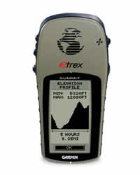
Built to travel on land or sea — eTrex Summit is the combination GPS, altimeter and electronic compass designed for the outdoor enthusiast.
Pinpoint Your Location — and Direction
eTrex Summit's barometric altimeter pinpoints your precise altitude, and its built-in electronic compass provides bearing information even while you're standing still. You can use the compass page to make sure you're staying on course to your destination. The Summit can also receive position corrections from the Wide Area Augmentation System (WAAS), which makes its already-accurate positioning data even more reliable. In fact, when you turn on WAAS, you can increase the accuracy of Summit's position reporting to within three meters.
Explore More
Like the rest of the eTrex series, the Summit boasts a powerful 12-parallel channel GPS receiver and a compact, sleek case that fits in the palm of your hand. The buttons are located on either side of the case, so you can operate the Summit easily, even with one hand. Summit is also IPX7 waterproof to withstand immersion in one meter of water for up to 30 minutes, so you can brave the elements.
eTrex Summit: What the hard-core outdoorsman has been waiting for.
Physical & Performance:
Unit dimensions, WxHxD: 4.4" x 2.0" x 1.2" (11.2 x 5.1 x 3.0 cm)
Display size, WxH: 1.1" x 2.1" (2.8 x 5.4 cm)
Display resolution, WxH: 64 x 128 pixels
Display type: 4 level gray LCD
Weight: 5.3 oz (150 g) with batteries
Battery: 2 AA batteries (not included)
Battery life: 22 hours (GPS only); 13 hours (GPS and compass)
Waterproof: yes (IPX7)
Floats: no
High-sensitivity receiver: no
Interface: serial
RoHS version available: yes
Maps & Memory:
Basemap: no
Preloaded maps: no
Ability to add maps: no
Built-in memory: no
Accepts data cards: no
Waypoints/favorites/locations: 500
Routes: 20
Track log: 10,000 points, 10 saved tracks
Features:
Automatic routing (turn by turn routing on roads): no
Electronic compass: yes
Barometric altimeter: yes
Geocaching-friendly: no
Outdoor GPS games: no
Hunt/fish calendar: yes
Sun and moon information: yes
Tide tables: no
Area calculation: no
Custom POIs (ability to add additional points of interest): no
Unit-to-unit transfer (shares data wirelessly with similar units): no
Picture viewer: no
Spec Sheet
Owners Manual
Owners Manual (Software Version 3.00 and above)
Quick Start Guide
Related Manuals
Garmin eTrex Legend Cx Handheld Navigator
Garmin eTrex Venture Handheld Navigator
Garmin eTrex Venture Cx Handheld Navigator
Garmin eTrex Vista C Handheld Navigator
Garmin eTrex Vista Cx Handheld Navigator
Garmin Geko 101 Personal Navigator
Garmin GPS II Mapping GPS Receiver
Garmin GPS II Plus Mapping GPS Receiver
Garmin GPS III Mapping GPS Receiver
Garmin GPS III Plus Mapping GPS Receiver
Garmin GPS 12 Personal Navigator
Garmin GPS 12CX Personal Navigator