Garmin GPSMAP 496 Portable Aviation Receiver
Garmin Updated: 2008-09-15 RSS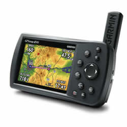
Fly smarter and safer with the GPSMAP 496 on board. This "know-it-all" mini-MFD puts more power and information at your fingertips than any other portable handheld in the history of aviation. Similar to the GPSMAP 396, the 496 combines satellite weather with a detailed color map and terrain alerting, then takes it up a notch with even more high-end software and features. The 496 is a "must have" for any pilot.
View Your Position on Taxiways
Garmin SafeTaxi® data provides detailed taxiway diagrams and position information for over 850 U.S. airports. Preloaded on the unit, this information helps you navigate unfamiliar airports with confidence and shows your aircraft's exact position on the field.
Access AOPA Airport Directory
Easily look up taxi services, plan an overnight, choose fuel stops and more with the Aircraft Owners and Pilots Association (AOPA) Airport Directory included on GPSMAP 496. It offers detailed information for over 5,300 U.S. airports along with the names and phone numbers of thousands of FBOs, plus ground transportation, lodging, restaurants, local attractions and more.
Receive Altitude-Sensitive Alerts
When in the air, Garmin's new Smart Airspace™ feature makes it easier than ever to identify what airspace lies ahead. Smart Airspace automatically highlights airspace close to your current altitude and de-emphasizes airspace away from the current altitude, which gives you increased situational awareness.
Enjoy Faster Update Rate
For added realism and safety, the 496 updates map data and "Panel" page instruments at 5 Hz, a significantly faster update rate that gives you a smoother, near "real-time" presentation of your aircraft's analog indicators, such as the HSI and turn coordinator.
Enhance Situational Awareness
GPSMAP 496 features a built-in Jeppesen database, and an Americas, Atlantic or Pacific terrain database. It also includes an obstacles database for the U.S. or Europe. Using this information, the 496 displays your flight route over contour terrain mapping. The higher-resolution terrain database includes over ten times as much data as the 396's for even more visual reference. With information from the terrain and obstacles databases, the 496 monitors your current position in relation to surrounding terrain to provide alerts. Even customize your own minimum clearance levels to receive terrain cautions. The addition of private airports and heliports to the database provides even more navigation and emergency "nearest" options.
Add Weather, Radio and Traffic
Make informed decisions based on weather and traffic with optional sensors and services. With a subscription to XM WX Satellite Weather™ and the included GXM 30A smart antenna, you'll have access to constantly-updated, high-resolution weather data for the U.S, right in the cockpit. Weather information includes Next Generation Radar (NEXRAD), Aviation Routine Weather Reports (METARs), Terminal Aerodrome Forecasts (TAFs), Temporary Flight Restrictions (TFRs), Lightning and Winds Aloft and can be laid directly over the 496's Jeppesen and topographic map databases. With an additional monthly service fee, GXM 30A delivers XM Satellite Radio to your aircraft. Add a Garmin Mode S transponder, and the 496 will also display TIS traffic alerts that identify surrounding air traffic.
Navigate by Air, Land or Sea
Garmin's GPSMAP 496 comes ready to go right out of the box with preloaded City Navigator® NT street maps, including a hefty points of interest (POIs) database with motels, restaurants, fuel, ATMs and more. Simply enter a destination, and you're automatically routed with voice-prompted turn-by-turn directions. In addition, GPSMAP 496 accepts customized points of interest such as school zones and safety cameras and includes proximity alerts to warn you of upcoming POIs. Add optional BlueChart® g2 data cards, and turn the 496 into a color chartplotter.
GPSMAP 496: The world's most highly evolved aviation portable.
Spec Sheet
Owners Manual (for Europe)
Owners Manual (for North America)
Declaration of Conformity
GPSMAP 496 Quick Reference Guide
GXM 30A XM Radio Smart Antenna Owners Manual
Related Manuals
Garmin GPSMAP 495 Portable Aviation Receiver
Garmin GDL 90 ADS-B Datalink Transceiver
Garmin GDL 69 Remote Datalink Receiver
Garmin GRC 10 Remote Control
Garmin GRT 10 Transceiver
Garmin GAD 42 Interface Transponder
Garmin GTX 32 Interface Transponder
Garmin GTX 33 Interface Transponder
Garmin CNX 80 WAAS/GPS Navigator
Garmin GDL 49 Satellite Data Link Transceiver
Garmin GNC 250 GPS/Comm Navigator
Garmin GNC 300 GPS/Comm Navigator