Garmin GPS III Plus Mapping GPS Receiver
Garmin Updated: 2008-09-16 RSS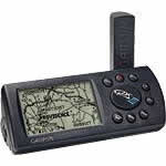
Garmin's GPS III Plus offers cartographic capabilities formerly found only in high-end automotive navigation and marine chartplotting units. Simply plug it into a PC and download an extra 1.44 MB of map data from Garmin's line of MapSource® disks to give you detailed maps.
Whether you're cruising the streets or pounding the waves, Garmin has the maps you need. Choose the U.S. Roads and Recreation software for city street level detail and even inland marine features such as lake and river shorelines, boat ramp and marina locations. Other software gives you worldwide coverage of coastlines, including a database of coastal cities, navaids and inland roads.
Even without additional cartography, the basemap in the GPS III Plus will get you where you're going. More than 10,000 new towns have been added to the permanent basemap, as well as airport locations, secondary roads in metro areas and even detailed exit information for the federal interstate highway system, including information about available lodging, food and service stations.
Spec Sheet
Owners Manual
Plus Features Addendum
Related Manuals
Garmin GPS III Mapping GPS Receiver
Garmin GPS 12 Personal Navigator
Garmin GPS 12CX Personal Navigator
Garmin GPS 12MAP Personal Navigator
Garmin GPS 12XL Personal Navigator
Garmin GPSMAP 60C Handheld GPS Receiver
Garmin GPSMAP 60CS Handheld GPS Receiver
Garmin GPSMAP 76C Handheld GPS Receiver
Garmin GPSMAP 76CS Handheld GPS Receiver
Garmin Rino 520 2-way Radio/GPS
Garmin Rino 530 2-way Radio/GPS
Garmin GNS 530W GPS Navigator